The ArcGIS Maps for Adobe Creative Cloud extension allows you to download GIS data into two Adobe Creative Cloud applications, Illustrator and Photoshop. While the methods for using the extension in both of these applications are similar, there are a few differences in the synced map’s layer structure for each.
Synced layers in Illustrator
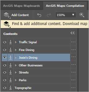
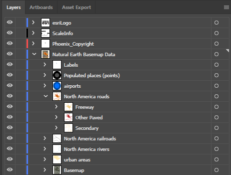
The Maps for Adobe Creative Cloud extension is designed so that the layer structure of a downloaded map in Illustrator will be that of the map’s original layer structure (see Image 1 and Image 2 below). There are additional layers at the top of the Illustrator Layers panel in your synced map. These layers consist of an Esri vector logo and copyright information (see Image 2). The copyright layer is named NameOfMapboard_Copyright.
If your map has labels, they will be in a layer called Labels and will be stacked above your artwork layers. Map labels are converted to text paths when the content is synced to Illustrator. Most labels appear in a single text path, with the exception of text on curved paths (splines) such as river labels. Labels for vector tile basemaps will be in the vector tile sublayers with the other vector tile data and artwork.


Synced layers in Photoshop
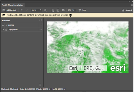
The Maps for Adobe Creative Cloud extension is a convenient tool for obtaining ArcGIS hosted raster data via Photoshop. The extension also allows you to download vector data in Photoshop; however, vector map data that is synced to Photoshop through this extension will become rasterized and flattened.
Hinweis:
When using Photoshop, a new TIFF file opens with the synced map added as an image.
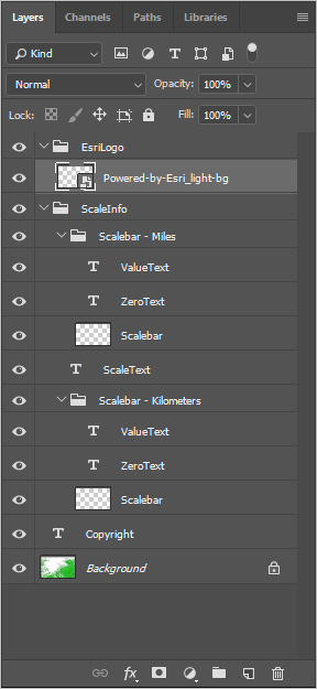
As in the layer structure in Illustrator, your Photoshop synced map has three layers at the top of your map layers consisting of an Esri vector logo and copyright information. See Image 4 below.

